Geo-Coding Egyptian Places
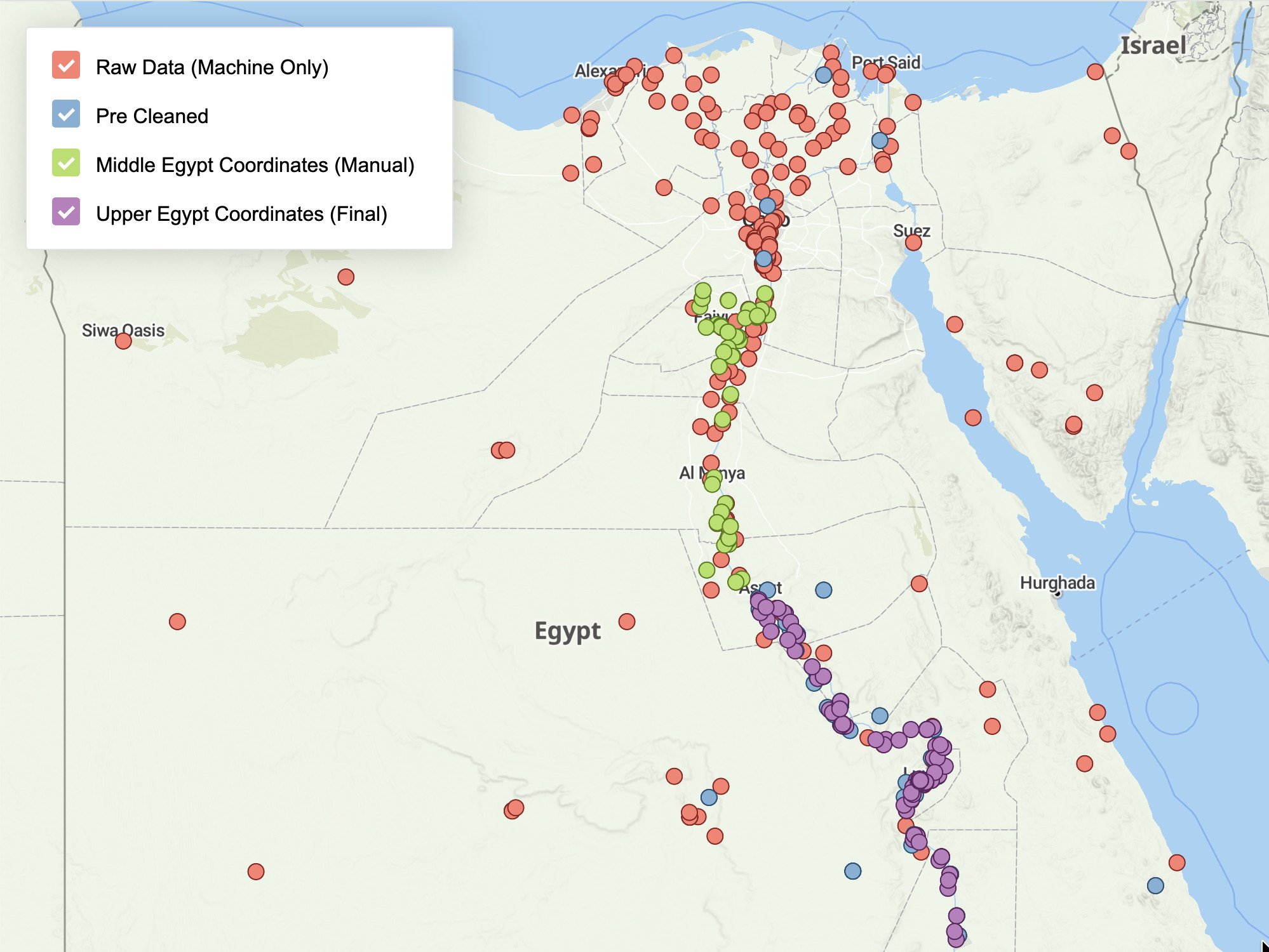
A proof-of-concept study that explored different automated approaches for assigning geographic coordinates to place names sampled from an in-house archaeological gazetteer.
Contracted by the British Museum’s Egyptology Department, my work involved batch processing of place names, setting up indexing infrastructure, and comparing matching results across external geographic resources such as GeoNames. The results were prepared and presented as interactive web maps to support analysis and discussion.
Beyond rule-based matching, the project included early experiments with large language models (LLMs) to help disambiguate ambiguous or conflicting place name matches.
Client:
The British Museum